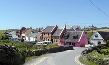
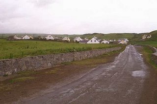
Generic description of Doolin

I can't do justice trying to describe my time in Doolin. At the risk of sounding cliquish, "You just
have to see it." The following in my feeble attempt to relay to you me experiences.
The landscape of the lower Shannon area is characterized by grassy glens and mountains. This supports the prominent dairy industry in the area. Also famous in the area is the Burren landscape, 'boireann' Gaelic for "rocky land". Described by a surveyor in 1640 'a savage land, yielding neither water enough to drown a man, nor tree to hang him , nor soil enough to bury." In this unique environment Mediterranean and alpine plants grow side by side.
Another distinct land form are the cliffs of moher. They rise to a height of 200 m out of the sea and extend for 8 km. This is made of layers of black shale and sandstone. We walked a total of 15 miles in two days just taking it in. Okay, okay! enough from Angela the biologist!


As you can tell, the unique landscape in combination with the village activities provide plenty of countryside entertainment. Apparently, there are two parts of Doolin, the village and the town. See if you can tell the difference!
Doolin was historically a fishing village and is now known as the traditional music capital of Ireland. You can head into one of the three pubs at half nine to enjoy the music. The musicians simply sit behind a table with their instruments and a pint and begin their 'jam session'. People from all over crowd in to listen clutching a pint of cider or Guinness. I sat at a table with people from Canada, France, Norway, US, UK, and Germany. The fun goes until the last person leaves, usually around 0130 or 0230.
*dramatic sigh* words escape me... I will try again later.


0 Comments:
Post a Comment
<< Home